
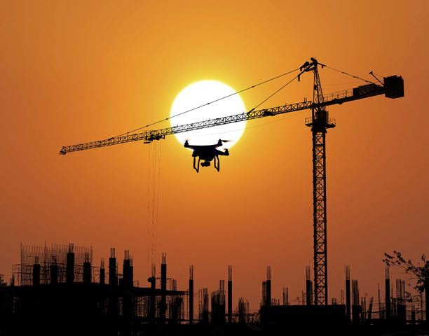
As RPAS technology advances, new uses of drones under construction are emerging. The possibilities are staggering and growing. Apart from traditional uses such as photography and video, techniques such as photogrammetry, infrared images, laser sensors, etc. allow obtaining very valuable information. The development of high-precision GPS with RTK technology allows drones to be able to replace conventional surveying methods. Let's look at some of these uses.
Proyección de renders sobre el terreno
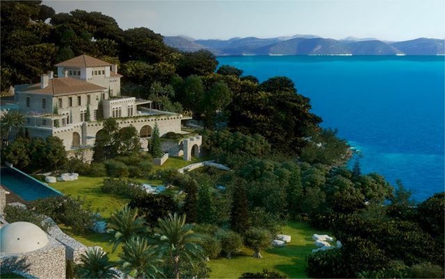
In the design phase of a building, elaborate models of the building can be designed with a high level of detail. Using 3D rendering software and carefully configuring the light sources results in images of the project that are difficult to distinguish from reality. If we capture aerial photographs of the plot with a drone to later implement these models, the level of realism is total. These images are very valuable for real estate agencies to increase their chances of selling the property "off plan", saving uncertainty and financing costs to the developer.
Levantamiento del terreno
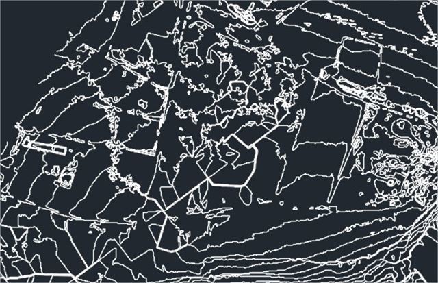
The use of aerial photographs georeferenced by GPS allows not only to measure distances and areas with precision, but also to elaborate models in 3 dimensions of the terrain through complex programs of identification of points and triangulation. These models give us real volumetric information, with which we can elaborate contour plans, calculate excavation volumes, volumes of stockpiles, etc. This information in the project phase allows accurate budgeting of excavation costs with a simple session of taking aerial images remotely, thus avoiding having to send a topographic team to evaluate the terrain.
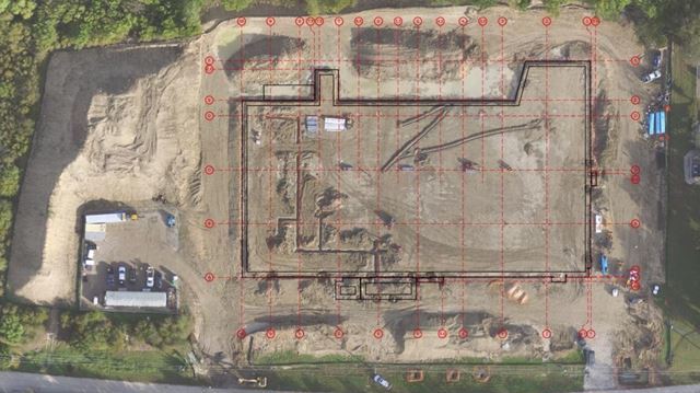
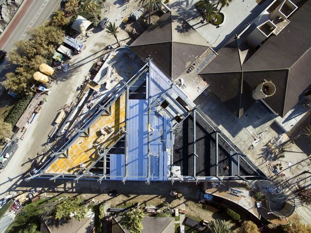
Implantación de obra
Aerial images are useful both for calculating clearing and intervention areas and, once the ground has been cleaned and leveled, to have a photographic plan to plan the implementation of the work taking into account the safety and the correct development of the construction process. With computer programs for image processing and stitching, images of large areas can be obtained without losing resolution, being able to reach several Gygapixels, with which this system can also be attractive for civil works. These images can be imported into CAD-like software as RASTER images for processing and measurement.
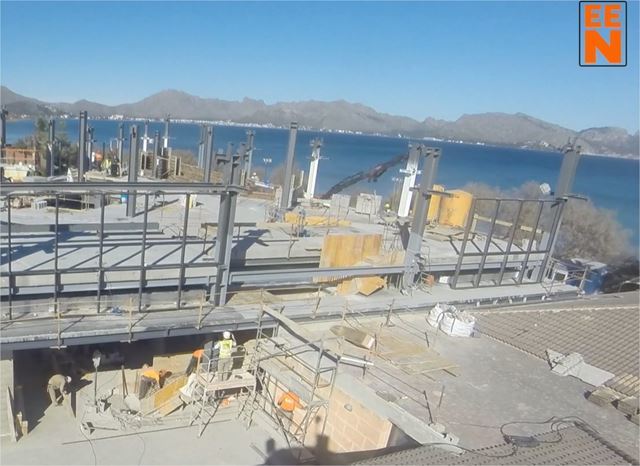
Seguimiento y control
In projects carried out by large companies that operate nationally and internationally, such as hotels or shopping centers, it is common to have members of the project management who have the confidence of the developer and do not reside near the location of the construction, having to move constantly to carry out the control. The aerial images and video allow to monitor the work remotely, being able to avoid some of these displacements and save costs therefore.
Vigilancia automatizada
Advances in robotics are allowing the development of a generation of autonomous vehicles equipped with artificial intelligence that carry out increasingly complex surveillance tasks. There are robots with proximity sensors and cameras that can be deployed in unknown environments and quickly recognize them and establish optimal surveillance routes. Drones are no exception. Security companies already offer this type of service, with drones that follow random patterns on their routes and autonomously return to the charging point making it very difficult for copper and tool thieves. Having an aerial vehicle buzzing and shining light on the construction site is also a great deterrent. In the field of experimentation still, there are even swarms of drones capable of communicating with each other, with collective artificial intelligences that allow them to map buildings even from the inside at high speed.
Promoción inmobiliaria y corporativa
Aerial imagery or the elaboration of a promotional aerial video are already classic forms of marketing with the use of drones in many industries. The use of drones in construction is no exception, both real estate and developers for the sale of the property, as well as the construction companies themselves for corporate promotion are potential customers of this type of services. The combination of aerial shots with interior shots, and even with timelapse videos of the development of the construction process give very good results.
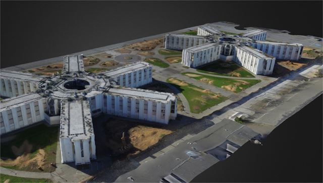
Modelado 3D de edificios existentes
The taking of georeferenced aerial images allows us to elaborate the 3D model that we have already mentioned, not only of the terrain but also of existing buildings, generally with slightly different techniques that use oblique images. Reproducing a 3D model of emblematic buildings and architectural heritage for study and conservation is not the only use that can be given to it. It is also possible to use this model to perform volume calculations, or as a quick way to print mockups with 3D printers true to reality and without having to invest large amounts of time in taking measurements to produce the model manually.
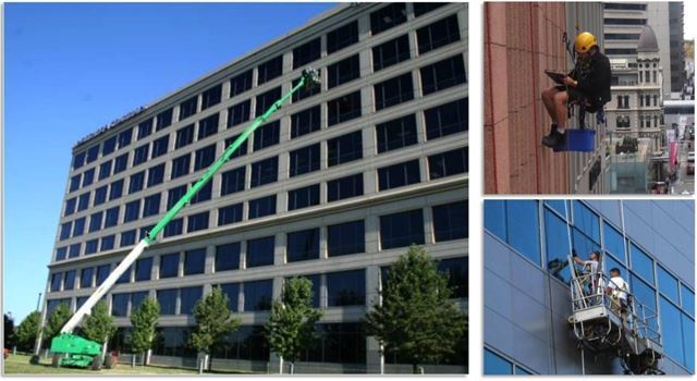
Inspección de estructuras, fachadas y tejados
Both in buildings under construction, as in any other building, inspections are necessary at some point in the useful life. Depending on the geometry of the building, it can be very difficult to access some areas to inspect them. Drones solve this problem, making it easy and economical to a task that could otherwise prove costly and compromise people's safety. It is no longer necessary to mount scaffolding or rent cranes, a drone flight can quickly provide us with the point of view we need a few centimeters.